Selway & Paradise Estimates & Observations
Name
CFS
Height
Source
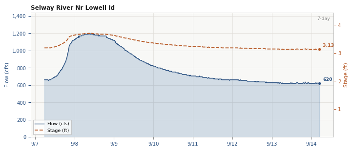
Lowell
620
3.13
USGS
Paradise
N/A
0.39
Estimated
Paradise (USFS observed)
N/A
0.4 ft
USFS
2026-08-28
not today Cutoffs
Height @ Paradise
IK
Kayak
Raft
Selway Monthly Average CFS
NOAA forecast
Loading forecast…
Daily USFS Paradise Gage Height
Permit Information
Important Dates
Date
Description
December 1 - January 31
Applications for lottery control season launch dates are accepted until 11:59 PM Mountain Time.
February 14
Lottery results announced
March 15
Deadline to confirm awarded reservation, 11:59 PM Mountain Time
March 16
Unconfirmed/declined/cancelled lottery dates are released for reservation at 8 AM Mountain Time
May 15 - July 31
Permits are required to float the Selway River (assigned by lottery or through a cancellation)
August 1 - May 14
Pre and Post Season - permit not required
- Permit Details
- Selway permit lottery application
- Water levels >= 5 feet at the Paradise gauge, or the road to the launch site is snowbound, cancellation penalties will be waived.
- Maximum party size is 16
- Group size is limited to 20 people outside the permit season. All other rules and regulations still apply.
- Required Camping Equipment
- Groover or portable toilet with appropriate capacity
- Fire pan (metal, 3-inch sides, minimum 144 sq. inches for containing embers)
- Strainer
- Shovel and bucket
- Ash container